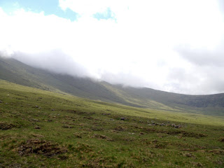
 Bright sunny day
Happy birthday to me! It looks like there was some rain overnight, but the sun is out today, which is very important on a mountain climbing day! (Remind me to tell you about my near-death experience climbing Mt. Katadhin in Maine…)
 Today is my 56th birthday, and today we will climb Mt. Brandon, the highest elevation of our hike.
Our hosts reminded us that this is Bank Holiday Weekend (like Memorial Day) and that all the B&Bs going forward were likely to be booked for the next few days, so we asked to be booked ahead to O’Connor’s B&B in Cloghane (silent G again, pronounced Cla HAHN) tonight.
Maurice told us to take our time climbing and enjoy the day – he thought the climb could be done in 3 to 5 hours, not the 7 to 9 in the guidebook. The guidebook hasn’t been wrong about times so far, so we took this with a grain of salt.
 Jim was very supportive of my needs today, and we stopped frequently on the steep ascent so I could catch my breath (my asthma kicks in when I climb). A solo hiker cruised by us after an hour’s walk, going about triple my speed and practically sprinting up the trail!
You know you are almost at the top when you find yourself in the clouds – all of a sudden it’s very windy and there is no more sun.


At each stage of the climb, you can only see the section in front of you – looking behind doesn’t give a sense of how high up you are, and the town and houses below can no longer be seen.


We were almost at the top when we spotted an ancient standing stone, decorated and with Ogham writing (slash marks) on each side. This is the closest we've been to one of these stones, although we've seen several at a distance.

Jim got to the top ahead of me, so he could record my moment of victory!


We reached the top (we climbed the shoulder of the mountain - our guides were unanimous in warning us not to attempt the summit) by noon, and then started a treacherous scrabble down the big boulders on the other side.


At some points it was easier to “crab walk’’ with my hands then to risk missing a footing on the jagged rocks.

When we got back into the sunshine, we stopped on a huge flat rock to have our lunch of lamb and cheddar sandwiches, provided by the pub this morning. Unfortunately, we shared this space with a goat who came to a bad end...
Jim was boiling water for hot cocoa, when the scrub brush on the rock caught fire, and he almost sacrificed one of his gaiters stomping it out! Happily, he did not sacrifice the cocoa, which was very delicious.

As we were finishing our lunch, who should arrive, but the Germans! They sat on adjacent rock and had lunch too, and Kirsten chided Jim that this was no way to treat a lady on her birthday!


The descent evened out after a while and became a gravel path that our guidebook described as “desolate” but we thought was quite pleasant.

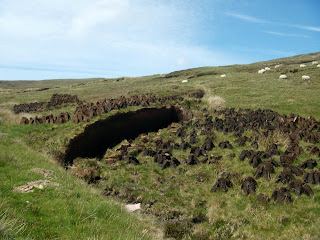
We passed a tractor cutting peat out of the hillside (peat is burned for fuel).
 As we approached the town of Brandon, we stopped at the artist’s studio and gallery of Mary Neville, who had some beautiful works in oil. Jim intuited that she had lived in Asia, and they talked about this while I looked at the paintings.
 We continued on the road, opting to not walk through Brandon town, as we’ll be walking on the beach tomorrow.
We were very happy to arrive at O’Connor’s B&B, where Micheal O’Dowd was most gracious and gave us a room on the first floor (no more climbing today!) with a bathtub (another person who thought I would benefit from “a good soak”!)
After cleaning up, I felt human again, and we went into the restaurant (where Mr. O’Dowd said I looked much younger than the lady that he’d seen earlier…). I ordered the poached turbot in port wine sauce at our host’s suggestion, and Jim had the scampi. Do I need to add that we each had a Guinness? The food was exquisitely first rate – a wonderful birthday dinner! We didn’t leave a crumb…


